
Small Grants – Funded Projects 2026
Deposit Data
In March 2026, the HSDS announced the funding of over £550,000 to fund 27 projects to support researchers, institutions, and community partners in advancing heritage science capabilities through the HSDS Small Grants Programme. The funding for these projects were made available through the generosity of AHRC's RICHeS initative.
Each project was carefully assessed and selected through a competitive application process, evaluated by a panel of experts who assessed each proposal on its excellence, feasibility, and value for money.
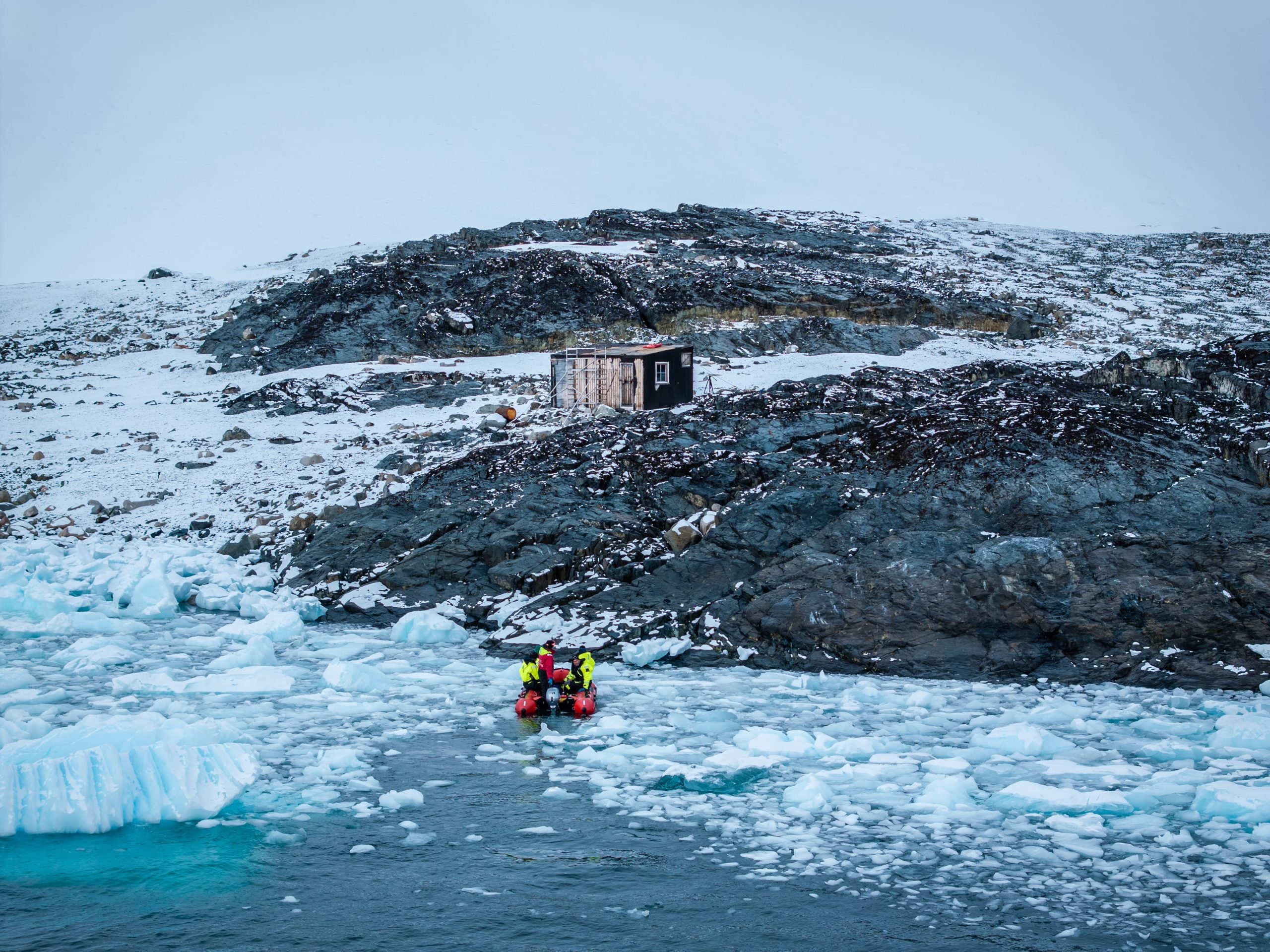
Blaiklock Island 2025 - Copyright UKAHT, Michael Duff
Below are summaries of each of the funded projects, separated into two streams; the first to fund projects that seek to enable and enhance access to reference collections from heritage science and conservation research and the second to provide an opportunity to work with The Hartree Centre to develop tailored Virtual Research Environments.
Click on the project titles below to learn more about the innovative heritage science activities undertaken by organisations from across the UK.
Enable access to heritage science and conservation resources
This funding stream supports projects that seek to enable or enhance access to reference collections and/or data from heritage science and conservation research.
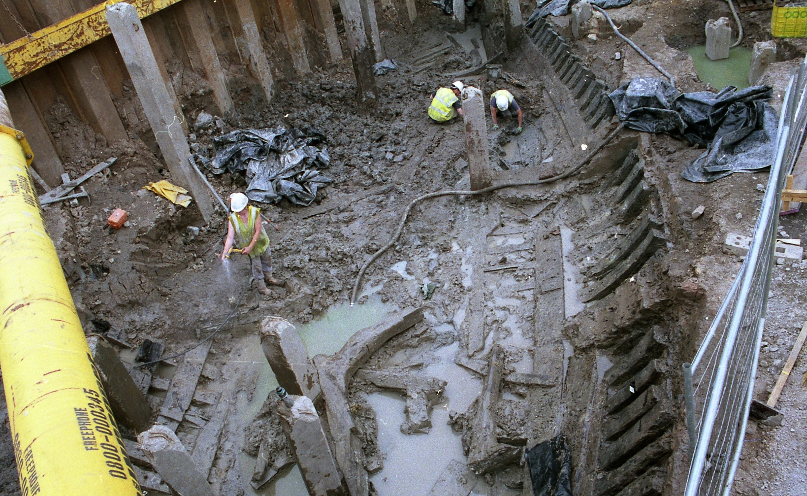
Newport Ship Excavation - Copyright Newport Museums and Heritage Service
Excavations at Ashton Roman town, Northamptonshire, are some of the most significant of a small Roman town undertaken in Britain. An important but under-researched aspect of the site is the remains of a large 3rd to 4th century AD Roman cemetery containing 267 individuals. The number of remains makes it the largest Roman skeletal assemblage within the East Midlands region and one of the largest outside of a major town ever to be excavated in Britain.
During the 1980/90s, analysis was undertaken on much of the artefactual assemblages from the excavations, however, analysis of the human skeletal remains was undertaken but unfortunately no report was ever published. This project aims to digitise data on these human skeletal remains, create a summary report for the assemblage and undertake targeted reanalysis of the skeletal material. With this data the project will develop a site-specific research agenda, to encourage future research, and utilise the digital resources to engage the public and other educational audiences.
For almost half a century, the Conservation Department at the National Galleries of Scotland (NGS) has gathered technical information related to its world class fine art collection held across five sites in Edinburgh. The records associated with these collections are mostly handwritten, they vary in format and level of detail, and are not currently stored in a single location.
Our project aims to organise the documentation of this important and growing archive into a digital format that will allow greater access to the NGS collection to a variety of audiences. This project will facilitate sharing, increase the visibility of the NGS collection and ensure its longevity and relevance. Crucially, it relates directly to the NGS core purpose to make art work for everyone.
Historic England's Archaeological Investigation team has accumulated a significant collection of drone-derived photogrammetric and lidar data. The data depicts upstanding archaeological monuments visible from the air including earthwork or structural elements ranging in date from Neolithic henges to 20th century military remains. These vast datasets have an immense value for the scientific understanding and preservation of England’s archaeological heritage, however, they are currently inaccessible to researchers.
This project aims to collate all relevant datasets currently held by HE, standardise and enhance the metadata for each and make it available via the HSDS as open access resources for the public, researchers, and heritage professionals alike. By preparing and depositing these datasets with the HSDS, this project will transform a wealth of archaeological data into a lasting public resource. The initiative supports heritage science research, education, and heritage management, while promoting wider public engagement with England’s past.
Charles Trollope, one of the world’s foremost experts in ordnance, has collected substantial research on British guns around the world, logging their location, dimensions, and information about their manufacture and history. Now in his 90s, he is respected for his unparalleled knowledge and expertise in the field. This project aims to digitise and make the Charles Trollope collection available to the public. This extensive collection consists of 25+ folders of photographs from film and dimensional records along with hand drawn diagrams, charts, research and correspondence with other experts.
Currently, these records are at risk of being lost due to a lack of accessibility and a lack of awareness of their importance. To safeguard the archive and convert it into a more accessible form, this project will digitise the collection and compile a reference catalogue so that they can be easily accessed by all, before depositing the files, including associated metadata, with the HSDS.
Hans Sloane’s vegetable substances dataset presents the botanical collection practices of Sir Hans Sloane (1660-1753) between the 1680s and 1750s. This unique heritage science resource represents an unparalleled historical collection of specimens from across Britain's expanding global trade networks in the 17th and 18th centuries.
From Folio to FAIR will create a comprehensive, interlinked heritage science dataset that brings together manuscript catalogues, created from before systematic biological naming, with high-resolution images and thousands of surviving botanical specimens held by the National History Museum. This resource will make over 12,000 historic entries and 8,000 specimen records accessible and usable as open access resources. By applying linked data, knowledge graph technologies, and digital archiving standards, the project will transform an important existing research dataset into a FAIR-compliant resource ready for long-term preservation and reuse.
Soapstone vessels are iconic markers of Viking settlement across the North Atlantic, carried by Norse migrants and used for centuries in new communities. By tracing where these objects originated, researchers can uncover vital evidence about Viking migration, settlement choices, and long-term cultural connections from the 9th century to the medieval period.
This project will gather, organise, and prepare 30 years of research data on soapstone vessel provenance for digital archiving. The data will consolidate geochemical and typological analyses from quarry sites and archaeological finds across Scotland, Viking period urban sites, such as York and Kaupang, and North Atlantic settlements in Iceland, Faeroe and Greenland. Making these data openly accessible will help researchers to map migration routes and understand how pioneer communities maintained connections with their Norwegian homeland while establishing new networks. The digital archive will support ongoing international research in Britain, Scandinavia, and beyond, preventing the loss of decades of publicly-funded research.
The UK Antarctic Heritage Trust (UKAHT) is the only UK charity caring for Britain’s rare heritage in Antarctica. UKAHT works in extreme conditions to conserve eight Historic Sites and Monuments that tell the story of human survival, courage and scientific discovery. Surrounded by dramatic landscapes and penguin colonies, these vulnerable wooden buildings are time capsules of Antarctic life. They are some of the only surviving examples of their kind, inspiring people globally. The Antarctic Peninsula is warming five times the global average and increasing temperatures and precipitation are putting these buildings and their artefacts at risk.
This project seeks to collate, document and preserve the vast datasets collected at these at-risk heritage sites, including Structure from Motion (SfM) Photogrammetry and Terrestrial Laser Scans (TLS), to make them a readable, accessible and valuable research resource. Once shared with the HSDS, the UKAHT aims to highlight the immense cultural and scientific value of these sites and datasets.
How have species and ecologies varied over the long term and what was the role of humans? Environmental archaeological data are highly relevant to resolving present-day societal challenges but there is limited awareness of environmental archaeological evidence, despite it being a long-established discipline. This may be linked to obscuring technical language and reliance on a relatively limited range of academic publishing avenues.
A new dataset of ~1.2 million plant and animal remains covering 5,000 years generated by the Fenscapes project at the McDonald Institute for Archaeological Research will be presented via the HSDS. The Online Atlas of Past Animals and Plants in the Fens aims to re-present this new dataset in an engaging and accessible way that encourages and empowers community members to interrogate the archaeological data by their own priorities and interests.
Radiocarbon dates are an integral part of the archaeological process and provide the timeline by which we understand the past. Historic Environment Scotland (HES) has commissioned over 6000 radiocarbon dates, however, the result certificates from those analyses are held in multiple locations, both physically and digitally. As HES is the primary repository for documentation from all development-led and research excavations in Scotland, it is estimated that there are a further 1000 certificates held within HES Archives.
This project aims to enable and enhance access to radiocarbon data through the cataloguing, digitising, transcription and linking of radiocarbon dating certificates held by the HES. This project will enable access to the original data and promote the re-use and re-interpretation of data in line with FAIR principles. This project will deliver a significant dataset of downloadable digital certificates and related documentation and metadata to HSDS via the HES Trove online platform.
Kent’s Cavern in Torquay, Devon, is one of Britain’s most important prehistoric sites. Excavations over the past 150 years have uncovered a record of human and animal activity stretching back more than half a million years, illuminating the deep history of our species in north-west Europe. The evidence from Kent’s Cavern is now dispersed, its story divided across more than forty museums and archives across the UK.
This project will create the first comprehensive gazetteer of all known Kent’s Cavern collections, artefacts, faunal remains, field notes, photographs, and documents. Working closely with museums and archives, the project will identify where material is held, what it includes, and how accessible it is, in order to make it easier for researchers to find and access this material. In doing so, the project will strengthen connections between institutions, inform future conservation and digitisation, and open new opportunities for collaborative research and interpretation to improve public understanding of Britain’s deep past.
In 2020-21, the University of Bradford’s Visualising Heritage team responded to an urgent need to capture in detail an accurate 3D digital record of Robert Stephenson’s Railway Roundhouse, unearthed as part of HS2 enabling works at Curzon Street, Birmingham. Together with adjacent historic assets, including the Grand Junction Railway Ticket Office, the Principal Building, the Eagle & Tun pub, and burial vaults at Park Street Cemetery, this digital assemblage represents significant heritage assets linked to Britain’s past, present and future railway history.
The project seeks to collate this unique digital data associated with HS2 for archiving, with a plan that overcomes some of the challenges of funding constrained by formal contractual relationships during the enabling phase of HS2. The project will also facilitate long-term access and data discoverability, through the development of an associated multi-platform web-based resource that brings public-facing narratives together with detailed visualisations, offering a unique glimpse into the origins of modern rail travel as linked to the development of one of our key cities.
The Courtauld Institute holds a valuable archive of an estimated 14,000 paint samples taken from works of art examined by them, from the establishment of the Conservation department in 1934 to the present day. Works of art include the Winchester Round Table and the Palace of Westminster Coronation Chair as well as paintings by Botticelli, Rembrandt, Picasso and many others in public collections.
This project will create a catalogue of this data, enabling researchers to find and access this important information for the first time. It will also lay the groundwork for a future searchable resource that will connect technical analyses with archival and art historical data, enabling future researchers to address key questions surrounding the history of painting materials and techniques.
This project will transform access to archaeological sediment micromorphology data by using new digital imaging technologies to capture high resolution images of archaeological thin-sections. The work will generate ‘digital twins’ of around 1,000 large-format slides currently held at Durham University, enabling microscopic details to be examined by researchers at any location, away from the laboratory.
The work will also assess major collections at Cambridge and Reading to plan future digitisation of an estimated 5,000 additional slides, including material from internationally significant sites such as the UNESCO World Heritage Sites of Çatalhöyük and Ness of Brodgar. Alongside this, the project will establish best-practice protocols for contributing to the archive and develop a UK-wide service at NEMCAS to automatically digitise new slides, opening up previously inaccessible data to researchers worldwide and strengthening long-term access to this vital heritage science resource.
The British Geological Survey’s National Building Stone Collection, which includes over 4,300 specimens dating back to the 1830s, is a unique resource for understanding the materials that shape the UK’s historic built environment. These stones are vital for heritage conservation, enabling accurate stone matching for repairs and new construction that respect historical authenticity.
Currently, the collection’s data is fragmented across spreadsheets, scanned index cards, and high-resolution photographs, making access difficult. This project will unify these datasets, clean and standardise the information, and publish it as an open, searchable resource for heritage professionals, architects, and researchers. This will strengthen conservation practices, enable advanced research and help safeguard the UK’s historic environment for future generations.
Medicine chests, historic storage containers for medical supplies and medications, are found in medical, military, science and social history collections. The Science Museum Group holds many of these items including the medicine chest used by Sir Ernest Shackleton in his 1907-1909 Antarctic expedition. However, medicine chests are inherently complex objects to curate: they are historic, fragile and contain large numbers of chemical mixes that are hazardous.
This project will catalogue the chests to item level, create hazard records for each item and flag any controlled substances. Moreover, the project would establish a catalogue process for medical chests, which will be shared more widely and will ensure a standard approach, creating records for each item within each chest and checking for potential hazards. This information would be published on the Science Groups online portal, Collections Online, and shared with the HSDS, to be made available via our Data Catalogue.
The Hamilton Kerr Institute at the Fitzwilliam Museum holds an exceptional national collection of over 4,000 paint cross-sections from more than 800 paintings and painted objects. Built up over three decades, this unique resource underpins conservation, heritage science, and technical art history, yet remains largely inaccessible due to fragmented documentation and outdated imagery.
This project will create a pilot digital dataset and sustainable framework to unlock the research potential of the collection. A focused set of 500 paint cross-sections will be re-imaged to modern standards, accompanied by cleaned and digitised metadata, and integrated into an interoperable, searchable database. The result will enable researchers to access and compare samples and provide a scalable model for future digitisation of the full collection or collections beyond.
Virtual Research Environment applications and workflows
This funding stream provides an opportunity for successful applicants to develop an idea for a new virtual research environment.
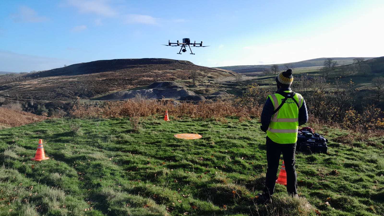
A drone being used in a rural environment. Copyright - Historic England
Radiocarbon dating has been a mainstay of archaeological research since the late 1940s, and since then has undergone many advances that have improved its accuracy and precision, including the application of Bayesian modelling. Bayesian modelling utilises prior information about the radiocarbon dates, such as the stratigraphic sequence, to narrow down date ranges and generate additional information about the sequence of samples found within it. Despite becoming the industry standard, fewer than 10 UK institutions have the infrastructure to offer complex Bayesian modelling, limiting access to this tool.
This project proposes the development of a VRE where researchers can access standard Bayesian modelling software through a virtual desktop, opening up the field to a wider group of people. The VRE would contain three main components: a web-based input module; an analysis program and a web-based output module. This approach is a simple and cost-effective way of democratising access to Bayesian modelling so that this technique can be of benefit by more of the heritage sector and beyond.
Recent innovations allow us to investigate the role of genetic diversity among crops in the past, particularly with regard to cereals. Geometric morphometrics (GMM) is an innovative technique that compares measurements of both ancient and modern cereal grains derived from microscope photographs. Subtle genetic relationships between varieties of different cereals can be determined, enabling us to ultimately to trace the ’genealogy’ of those cereals. However, the large-scale application of GMM is limited by the time-consuming, manual workflow that must be completed before statistical analysis can begin. This includes the tracing and measuring of hundreds or thousands of digital grain photographs.
This project will develop an automated workflow to streamline GMM analyses. As a case study, the VRE will draw upon the Bodleian Libraries’ unique, open-access collection of 6,599 photographs of archaeological grains from medieval England, which is ripe for GMM analysis. The automated workflow will provide the foundations for a new VRE in heritage science for analysing archaeobotanical image collections: an ’Ancestry.com for grains’.
Heritage crime is an offence that harms the value of heritage assets and their settings for both current and future generations. Over the past 15 years, Historic England and the National Police Chiefs’ Council have driven improvement in both police training and research that highlights the scale of these complex crimes. The challenge of recording, preventing and prosecuting heritage crime is exacerbated by a lack of standardised procedures across police councils for documenting, analysing and evidencing heritage crime.
This project proposed the development of a VRE that utilises techniques and datasets used by archaeologists, particularly in technology-driven recording and analysis, to enable the rapid access, processing and visualisation of point-cloud (e.g LiDAR and laser scanning) and other computer-heavy datasets to support heritage crime investigation. This VRE will break down barriers between sectors to enable collaboration, access to data and foster heritage science research that will have demonstrable social impact to the prevention of heritage crime.
Today, many organisations can capture complex surface data but lack the capacity to process, visualise and share it. Capturing and processing 2.5D representations of the earth surface requires the combination of photogrammetry and RTI to produce precisely registered large-scale mosaic photographs, dense point clouds, and depth maps. However, these datasets currently face a usability bottleneck. Generating dense point clouds, simplifying meshes and other useful techniques are computationally intensive and can take days on a typical computer for a single large asset.
This project will create a VRE that makes high-resolution surface-imaging workflows accessible to heritage organisations without specialist hardware or high-end computers. These workflows will allow users to generate high-resolution 2.5D (surface-relief) images that record surface features that are difficult to see in standard photography and are important evidence for conservation planning, technical study and public interpretation. These applications benefit conservators, curators and researchers by helping them make better use of existing and legacy datasets, reduce dependence on high-end computers, and more easily share surface information within and beyond their institutions.
The identification of cultural heritage features in airborne laser scanning data is a labour-intensive process, reliant on a small number of specialists. Artificial intelligence (AI) offers opportunities to accelerate this work and enhance the historic environment record, but adoption across the sector is currently limited. Previous outputs have rarely been shared, leading to duplication of effort, missed opportunities and a widening skills gap. This project aims to support the collaboration and training required to deliver public benefits from this new technology.
This project will develop a Virtual Research Environment to support the use of AI for automated feature detection of cultural heritage features within national ALS data. The proposed VRE will provide a user-friendly platform built with open-source tools and licensing, where researchers and heritage professionals can access national scale ALS data, run automated feature detection workflows and share models and outputs. This initiative will benefit a range of cultural heritage sector users, including remote-sensing specialists, local authorities, commercial archaeologists, academics and conservation bodies.